Heaven to Hell 1000 Ride ----Completed
August 22-23, 2012
Top of Pikes Peak  via
 Independence Pass and Ely, NV to Bad Water in Death Valley - lowest point in
 North America in 24 Hours

This ride was first finished in 2010 by Mike Kneebone, the
founder and president of the modern-day Iron Butt Association, and his son,
Kevin Masa. Some IBA riders may look down
their noses at Saddle sore 1000 mile rides, thinking that ONLY 1,000 miles in a
day in too easy. Well, although the
timing of this ride was not a problem, the roads and road conditions certainly
were a challenge.
When the ride was first conceived, the final portion of the Pikes Peak Highway was unpaved hard packed dirt. It is now paved. But that small difference made little impact on the difficulty of this ride.
The ride starts at the Visitor
Center at the top of Pikes Peak,
travels down the 20 mile Pikes
Peak Highway, through the high plains towards
Buena Vista, then over Independence
Pass and into Äspen. From there the we go to Glenwood Springs,
and pick up Interstate 70 to Salina,
CO, where we join US 50, known
as the loneliest road in the world, since most of it is through the high
desert.
At Ely, NV,
we head south to Beatty, NV, and then down down down to Badwater,
CA, the lowest point in the US.
There were two reasons for me to take this ride, along with
Tim Masterson and Joe Green. First and
foremost, it sounds like a neat ride.
Second, I wanted to collect National Park Service Passport Stamps from Colorado, Nevada and California. (We couldn’t get a stamp in Utah because of the timing and route of this
trip.) One serious negative about the
route is that you could end up riding through the desert on US 50 at
night. There would be no protection from
coyotes and other animals crossing the roadway in the pitch-black
darkness. And hitting one of those
critters would really ruin the day.
So we decided to start our trek from Pike’s
Peak at 3 PM. That time
would take us through Independence
Pass and to Glenwood
Springs during daylight, and put us on the Interstate just at darkness. We would then ride the Interstate until it
ended in US 50, spend 5 hours in a motel, and begin riding again at
daybreak.
The downside of this route and timing is that it would put
us at our destination around 2 PM—the hottest part of the day in one of the
hottest places on the continent. Oh
well, we chose safety over comfort and decided to go with the 3 PM departure
time.
 |
| Joe Green, Howard Entman, Tim Masterson |
We arrived at the Visitors
Center early, about 1:30
PM, parked our bikes, and got off.
Wow! After just three steps I
found myself breathing rapidly—the 14,110 foot altitude makes a difference.
So I decided not to run, just walk slowly to the water
fountain for a nice drink.

I noticed a big sign indicating that this weekend was the
Pikes Peak Ascent and Marathon, where runners
run up the mountain from the base, a running distance of 13.3 miles on dirt
trails, climbing about 8,000 feet while they do it. I like to participate in running events, but
that one’s not on my bucket list!
At 2:56 pm I bought a donut, got my starting cash register
receipt with the time and date, and walked, slowly, back to the bike for the
start.

The ride down was slow.
The road is twisty-turny, and has a double yellow line most of the 20
miles. Most cars drive slower than
motorcycles, so even in low gear, I was riding the brake for a lot of the
way. Some 40 minutes after the start, we
arrived at the base and were able to pick up some speed.
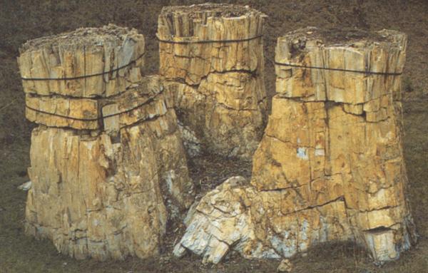 |
| Petrified redwood stumps |
Thirty miles or so from the base, we took a quick detour to Florissant Fossil Beds
National Monument for a
passport stamp. The traffic was very
heavy coming towards us, but just moderate in our direction. The road is two lane, with long stretches of
double yellow lines, so our speed was less than I had planned, but we all had
large fuel tanks, so we didn’t have to stop often.
 |
| Narrow roads in the mountains |
After getting to Highway 82 just north of Buena Vista, we began the
ascent to Independence
Pass. The two lane road has several switchbacks and
many small sections of “narrow road.”
The narrow portions, all running along the side of the mountain, are
clearly not two lane roads. There is no
centerline. It is just a wide single lane. That’s why vehicles are limited to thirty
feet in length for this road.
Fortunately, we didn’t have any oncoming traffic on these narrow
portions.

As we descended from Independence
Pass, we entered the town of Aspen. It was around 7 PM, and the smell of garlic
from the many restaurants in town perfumed the air (and made me hungry). But we were about 30 minutes behind schedule,
so stopping for a nice bistro dinner was out of the question. Besides, Iron Butt riders rarely stop for a
restaurant dinner when on the road.
From Aspen
to Glenwood Springs the road became four lane, faster, but not as pretty. We fueled up at Glenwood and got on the
interstate just as it was getting dark.
The three hour, 250 mile ride on the interstate to Salina was
uneventful. Even on the interstate, you
must maintain awareness of what’s on the road ahead. There were no animals, but there were three
truck tire carcasses in the middle of the road on this stretch. Running over one of those could damage the
bike and the rider.
We had made reservations in Delta, UT, for the night. That was a one hour ride from Salina—again, a two lane
road, reasonably flat, but with no fencing on the sides to keep the animals
away. Even with my bright high intensity
headlights, I felt like I couldn’t see far enough down the road or to the
sides. On this stretch I saw one deer
along the side of the road and a larger brown animal, maybe a moose, in a field
about 100 feet from the road.
We checked in to the hotel, fell immediately to sleep, awoke
4 hours later without the benefit of an alarm, and ate a quick motel
breakfast. Then we were off, riding down
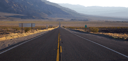
US 50 in the early morning sun.
 |
| Highway 50 |
The stretch to Ely is about 100 miles, and there were only a
few little towns along the way.
Otherwise, there was nothing but desert.
No cell phone coverage, few if any cars going the other way, and a speed
limit of 70 mph. Tim led this leg and
our speed was right at the speed limit.
Just after we passed the sign "Ëly City Limit,” there was a
large gas station, but Tim passed it and continued into and through town; he
also passed the intersection with Highway 93 where we needed to turn left.
Several blocks farther, Tim did turn left and we stopped at a
smaller gas station, where we fueled. He
had put this gas station in his GPS some time ago when we talked about spending
the night in Ely. In any event, it took
15 minutes or so to find our way back to the highway—we had a grand tour of Ely
as our GPS kept trying to take us onto unpaved hilly streets in town. At this point, I pulled into the lead and
picked up the pace just a little.
The road to Beatty was much like the road to Ely—barren
desert with a town every 50 miles or so.
The rawness of the landscape was beautiful!
The temperature in Ely was pleasant, but the closer we got
to Beatty, the warmer -- no hotter-- it got.
Three miles before Beatty there was road construction
narrowing the road to one lane with a sign that said “Expect long
delays—possibly 30 minutes.” This is NOT
what any rider on a timed run wants to see.
Fortunately, our side of the road was moving slowly when we arrived—we
didn’t have to wait at all. The single
lane stretch was about 5 miles long and took 15 minutes to cover. Had we arrived 5 minutes later, we might have
been stuck there while the cars from the other direction made their way.
Sitting on your bike in full riding gear, in the sun, in the
desert, would not make for a fun experience!
At this point, we knew that we would meet our time objective
at Badwater, which was some 45 minutes away.
Tim and I took off our shirts and soaked them in the sink at the gas
station. This would keep us cooler for
the ride into Death Valley. Joe decided not to do this. And off we went.
 |
| Highway 190 in Death Valley |
 |
| Note the air temp |
The paved roads in Death Valley
are excellent. The speed limit in the
park is 45 mph, but everybody travels a little faster. On the way, we stopped at the park’s visitor
center in Furnace Creek for our stamp.
We didn’t stay here long, because the temperature was 113 degrees!

Fifteen minutes later, we arrived at Badwater. We made it!
 |
| Self portrait |
The trip, including our rest stop, took a little more than 23
hours—essentially what we had planned.
There were no íncidents along the way.
All in all—a great trip!
No comments:
Post a Comment